K2 Base Camp Trek Guide: The Complete Trekking Resource

People often ask me: what is the best trek in Pakistan? While I am not one to define what’s the absolute “best” since there are so many trekking possibilities in this country – I’ll say this: the K2 Base Camp Trek is one of the most rewarding active adventures one can embark on in Pakistan.
Nestled deep in the Karakoram mountains in the borderlands between China and India lie four of the world’s 8000-meter peaks, including the namesake mountain for this trek; the world’s 2nd highest mountain: K2. Of all the treks I have done in my life, none quite stack up to the sheer raw beauty and scale one encounters on the K2 Base Camp Trek.

I have now done the K2 BC Trek three times and led two groups of adventurers there – and I have learned a TON along the way. This epic guide to the K2 Base Camp Trek breaks down everything you need to know to prepare for this hiking adventure of a lifetime.
Below I’ll cover a daily overview of the K2 BC trek details, visa information, my personal trek packing list, when to go, and how to best prepare for your trip.
If you have done Everest Base Camp or another long-distance trek at altitude and you are wanting to up your game, this K2 Base Camp Trek guide will show you the way to your next big adventure…
Trekking to K2 Base Camp: 10 Things You Should Know When Planning Your Adventure
The trek to K2 Base Camp is not something you can just rock up and do. It takes time to prepare your gear, body, and crucially – the paperwork.
Before we dive into the meat of this K2 Base Camp trek guide, here is a quick list of things you 100% should know when you are in the planning phase:
1. Central Karakoram National Park is a Restricted Area
A national park that lies within an army-controlled restricted area? Welcome to Pakistan.
Due to simple geography and natural borders with India and China, the area contained within Central Karakoram National park (CKNP) – where K2 and 3 other 8000 meter peaks are located falls in an area controlled by the Pakistani army.
This means one thing for trekkers: more paperwork. Luckily though, your tour operator handles most of this stuff for you.
2. The Trekking and Mountaineering Visa
In 2020, the Pakistani authorities changed the way they issue permits for foreign trekkers. It use to be the case that you could obtain a Pakistani tourist visa per usual and then have the company you booked sort out the rest of the permits for you.
These days, things are slightly different. Now, you must apply for the Trekking and Mountaineering Visa – NOT the plain ol’ tourist visa. The major downside to this is the time it takes to obtain.
This year it took me 2 months to get the visa – when I have had same-day approval for a tourist visa in the past. This means you need to apply well in advance of when you plan to start the trek.
Once obtained, you typically submit your visa to the tour operator you booked with and they sort out the final permits and clearance. As long as you give yourself enough time to obtain the visa, the whole process is pretty straightforward so don’t be intimidated!
3. The K2 Base Camp Trek is an Expedition-Style Trek
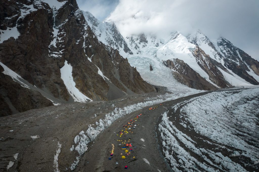
Once you leave the jeeps behind in Askole or Jhula, there are no permanent settlements, hotels, tea houses, or proper shops. This is a wilderness area where all of the supplies for the expedition are brought in by each group on the backs of mules and human porters.
You need to pack accordingly!
It is possible to buy Cocacola though at some of the higher camps. The price can be as high as $10 a bottle.
If you are wanting to learn how to start mountaineering, then going on an expedition-style trek is a great way to get the feel of what a proper climbing expedition can entail.
Check out my friend Jackson’s complete K2 Base Camp Trek guide for a first-hand account of our trip.
4. K2 Base Camp Sees Less Than 1000 Hikers a Year
In stark contrast to the Himalayan treks in Nepal like the Everest Base Camp trek or the Manaslu Circuit trek – K2 Base Camp sees less than 1000 foreign visitors each year (even less with Covid). That is compared to the 100,000+ that make the trek to Everest BC every year.
That fact is mindbending to me, given that K2 is the world’s 2nd highest mountain.
5. Weather is Highly Variable
At lower altitudes, it can be so hot that people get heatstroke. Above 5000 meters it could snow on any given day. On the K2 Base Camp Trek, I have literally experienced every single season and wild swings in temperatures over the course of a 14-day hike.
Mentally, physically, and with your packing list – it is important to prepare as much as possible for the harsh environment of the Karakoram.
6. Army Outposts in CKNP
By now you know this trek takes place in a restricted area. So along with the massive glaciers, towering peaks, and mule trains are also far-flung army outposts.
Having the army out there does not really have an effect on the trekker’s experience in any way. It is worth noting here as it explains why on clear days you’ll see military helicopters running supplies and personnel out and back along the glacier.
7. The Highest Point on the Trek is Gondogoro La
There are a few different ways to complete the K2 BC Trek. The classic route is the straightforward out and back journey along the Baltoro Glacier.
A far more interesting route turns the trek into a loop of sorts – culminating in a high-altitude pass crossing of Gondogoro La at 5,585m. I recommend going this way if possible as the views are insane. Loop hikes tend to always be more interesting as well.
8. Helicopter Rescues are EXPENSIVE
This is not Nepal; helicopter rescue operations do not happen in Pakistan very often and thus, they are very expensive. At last check, it costs around 15k USD to be evacuated from K2 Base Camp.
Make sure: 1. you have insurance covering you up to 5000-6000 meters for heli rescue and 2. make sure the tour operator you book with pays the heli-deposit to Askari Aviation in Islamabad. The helicopter will not come for an injured person unless they are paid first.
Budget tour operators for local Pakistani groups DO NOT pay this heli-rescue deposit so if you go on a budget barebones trip – know that you are also taking the option of a heli-rescue off the table in a worst-case scenario.
9. There is Internet Connection at Concordia?!
Northern Pakistan is a region in which internet connectivity is mediocre in the best of times. So in the summer of 2021 when I turned up to Concordia (4,600m) – I was shocked to learn that 4g internet was possible thanks to a recently built cell tower.
In order to pick up a signal though, you will need an SCOM SIM card, which you can easily buy in Skardu – that is if you must have internet out here.
10. Drinking Water Along the K2 Base Camp Trek Is Not Great
Despite being in a wilderness area – I don’t recommend drinking most of the water sources without doing some sort of filtration. Many of the campsites have mule waste (or worse) scattered around and the heavy mineral content of some glacier water can upset stomachs and cause problems.
This has been a problem for individual trekkers and guides in the past – and no joke – I have seen people turn back after the first day because they got super sick from drinking bad water. You don’t want that, and there is no reason why that should happen to you with the tools we have at our disposal.
Bring a Grayl Geopress and purify your daily drinking water to avoid getting a potentially trip-ruining stomach bug.
K2 Base Camp Distance
K2 Base Camp Trek Quick Facts:
- Distance: 160 km Jhula Camp – K2 BC and Back
- Days required: 12-14 days
- Total Incline: 10,000+ m (with ups and downs)
- K2 Base Camp Altitude: 5000 Meters
- Difficulty: Strenuous
Depending on which route you take – from the time you take the Jeep in Skardu, start trekking, and return back to Skardu is about 12-14 days, depending on your exact itinerary.
On average, it has taken my group about five days to reach Concordia and six to reach K2 Base Camp. Throw in a few rest days, changes in the itinerary due to weather, and the return journey, and the trip can easily extend to 14 days.
Taking the time to not go too high too fast will aid in the acclimatization process – which is not to be overlooked.
The trek can be a bit shorter (by kilometers) if you are going with a group that also does Gondogoro La pass. From Ali Camp (the last camp before the pass) to GG LA and down to Kuisbang is the most challenging day and takes the average person around 10 hours to complete.
Note: Askole village is no longer the starting point for the trek. Most expeditions now start from Jhula Camp thanks to a newly finished jeep track that extends deeper into the national park. This allows trekking groups to skip the rather boring day from Askole to Jhula.
Want to Join a K2 Base Camp Trek in 2022?
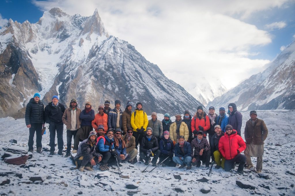
I will be leading a group on the K2 Base Camp Trek and Gondogoro La in July 2022 with my company Epic Backpacker Tours. Space is very limited so get in touch if you are keen to join me and my fantastic team of experienced Balti guides.
What to Pack for the K2 Base Camp Trek
The gear you bring on the K2 Base Camp Trek will determine the kind of experience you will have. If you skimp on any of the important stuff, you could put yourself in potentially life-threatening danger.
On one occasion, I have even had a client turn up with a summer sleeping bag rated to 20 degrees C (68 F). The client promptly bought a new one in Skardu under my firm encouragement.
The point being, the equipment list for this trek is very important to follow. The top five things you MUST not skimp on are:
Here is the list of gear that I personally used on the K2 Base Camp Trek and other long-distance high-altitude treks in Pakistan. The extra stuff that is not 100% mandatory is labeled optional.
Trekking to K2 Base Camp: A Day-By-Day Breakdown

So what is the daily experience and trail like when you start trekking to K2 Base Camp? Below I offer my experiences with a day-by-day breakdown of each section.
Keep in mind that itineraries are subject to change due to delays with permits, weather, or a variety of other factors that are just the norm of traveling in Pakistan.
Here is a typical K2 Base Camp Trek itinerary from Islamabad to Islamabad:
K2 Base Camp Itinerary
- Day 1: Islamabad Arrival
- Day 2: Fly to Skardu
- Day 3: Market Day in Skardu
- Day 4: Drive from Skardu to Jhula Camp (3150m)
- Day 5: Jhula to Paju (3,383m)
- Day 6: Paju – Khoburtse (3,566m)
- Day 7: Khoburtse – Urdukas (4,130m)
- Day 8: Urdukas – Goro 2 (4,250m)
- Day 9: Goro 2 – Concordia (4,600m)
- Day 10: Concordia – K2 Base Camp (5000m)
- Day 11: Rest Day at K2 Base Camp
- Day 12: K2 Base Camp to Concordia
- Day 13: Concordia – Ali Camp (5000m)
- Day 14: Ali Camp – Gondogoro La Pass (5,600m) – Kuisbang (4,700m)
- Day 15: Kuisbang – Saicho (3435m)
- Day 16: Saicho – Hushe – Drive to Skardu
- Day 17: Rest Day/Contingency Day in Skardu
- Day 18: Rest Day/Contingency Day in Skardu
- Day 19: Fly to Islamabad
- Day 20: Contingency Day in Islamabad
- Day 21: Client Departure Day
Day 1: Jhula to Paju (3,383m)
Distance: 20.5 km
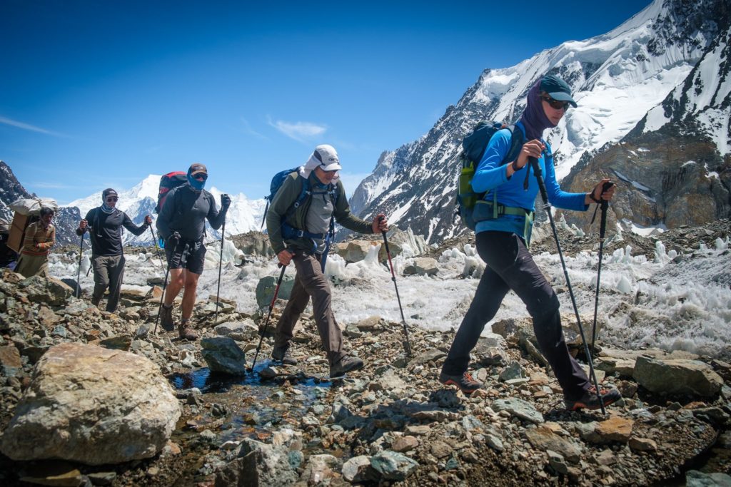
Trail report: Early start with 7-9 hours of trekking. Mostly flat with small gains and descents. The day is hot, exposed to much sun, and dusty. Sunscreen and lots of water will be your greatest friend today!
There are not spectacular mountain vistas on day one of the hike, but you begin to have the feeling of being in the big mountains. Without any cloud cover, this day can be a bit of a slog. The dust from the trail sticks to your face as sweat beads down and the radiation from the sun can be intense.
I recommend soaking your Buff and hat in the small streams you pass every few hours.
Arriving at Paju Camp feels like you have reached an oasis of sorts and there are plenty of trees to enjoy some shade after a hard-earned first day.

Day 2: Paju – Khoburtse (3,566m)
Distance: 14 km
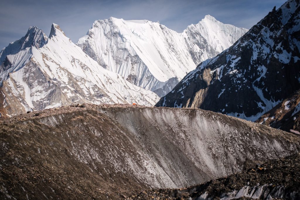
Trail report: 6-8 hours of hiking with a lunch break. After about an hour of walking, the dirt trail and the Baltoro Glacier begin. The trail follows the mighty Baltoro on and off until Concordia. The terrain is hilly, rocky, wet (in places), and uneven, with a few scattered bits of a “proper” earthen trail. Khoburtse camp can feel a bit cramped, but there is a beautiful waterfall nearby as well as great opportunities for sunrise viewpoints. The general view from camp is nothing to scoff at.
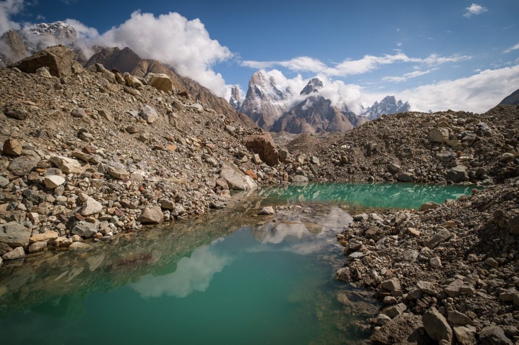
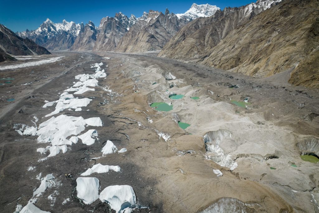
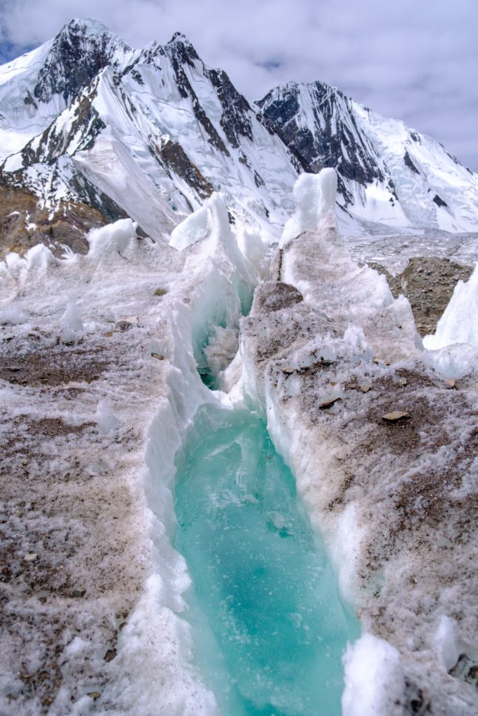
The Baltoro provides a (mostly) welcome change to the dusty trails of day 1 – with cool glacial caves, blue and green ponds, and trippy ice formations to be seen around every corner. The views definitely start to pick up in grandeur – and this is only day two!
Many trekkers opt for a quick “bath” in the small cold stream just beyond the lower side of camp.
Day 3: Khoburtse – Urdukas (4,130m)
Distance: 6.75 km
Trail report: Easy day, finishing after about 6.75 kilometers (2-4 hours). The trail gains in altitude but nothing too physically demanding. As always – be mindful not to push yourself too hard or sleep too high too fast. Urdukas is a truly spectacular campsite, and one of the favorites along the whole trek.
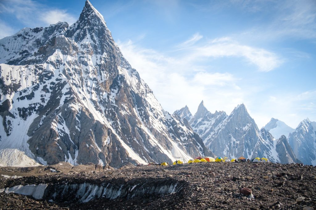
There are excellent views of Trango Towers, Muztagh Tower, and Lobsang can be seen directly from the camp. Urdukas is where being ever-deeper in the Karakoram range really starts to hit home. It’s epic.
Here it is possible to have a small, freezing “shower” – with an incredible backdrop of mountains behind you. The water is cold, but very refreshing if you make it here early enough in the day. The nights can be chilly.
Dig the photos in this guide? Check out my K2 Base Camp trek photo gallery.
Day 4: Urdukas – Goro 2 (4,250m)
Distance: 12 km
Trail report: 5 – 8 hours of moderate difficulty up and down glacier terrain. Today you will be starting to feel the altitude. Lunch stop is at Goro 1, by a small stream and under a burning sun if there are no clouds. Temperatures can drop below zero at night at Goro 2.
Expect spectacular views along the trail of Masherbrum, Gasherbrum IV, and the summit tip of Broad Peak can be seen from just outside your tent.
Goro 2 is the point in the trek where the landscapes begin to look other-worldly. Strange ice formations the size of a large house rise up from turquoise glacial rivers whilst towering peaks dominate the horizon on all sides.
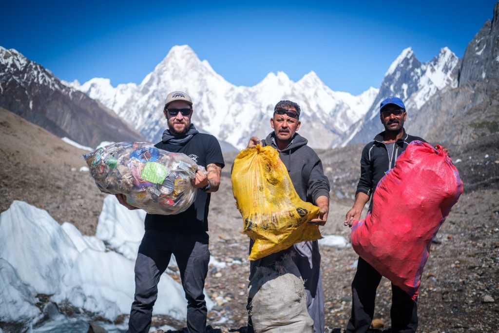
Real talk though: Goro 2 campsite can be a bit of a rubbish heap sometimes. Every year I organize a trash clean-up here with my group in an effort to reduce our impact and improve the overall vibe of the place – from trash heap to the epic campsite that it is.
Day 5: Goro 2 – Concordia (4,600m)
Distance: 14 km
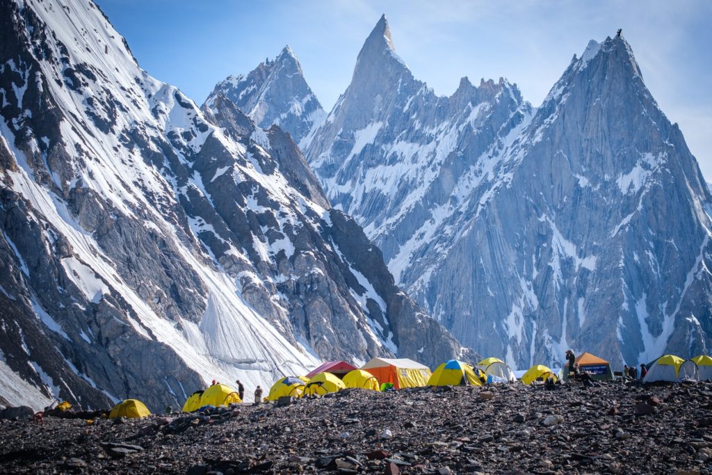
Trail report: Today we reach the “Throne Room of the Gods”, aka Concordia. 5-7 hours of pleasant trekking over the glacier, with more ice present than previous days. Amazing views of Gasherbrum IV, Mitre Peak, Broad Peak, Marble Peak, and of course, K2 can be seen from camp! Temperatures at Concordia drop well below freezing at night and snow/snowfall is possible here any time of the year. After a great dinner and solid rest, tomorrow we head to K2 Base Camp.
Concordia is simply one of the best campsites in the world – full stop. Nowhere else on earth can you sit with a steaming cup of coffee and take in 4 of the world’s biggest mountains (and countless others of formidable size).
Recently, the CKNP rangers installed drop toilets here – which vastly improves the sewage issues Concordia has faced in the past. That said, the porters still tend to go wherever they please – I don’t think I saw a single porter use the actual toilet. Hopefully, this improves.
Day 6: Concorida (4600 m) – K2 Base Camp (5000 m)
Distance: 14 km
Early start to K2 Basecamp. The total trekking distance to Concordia is roughly 14 km. The terrain is relatively easy though at this altitude – nothing is really that “easy” if we are being honest. Most of the route follows the Austen-Godwin glacier directly to the base of mighty K2.
Arriving at K2 BC usually produces a range of emotions. This is one of the major targets on the trek and standing directly beneath K2 drives that fact home in a very satisfying way.
Be sure to visit the Art Gilkey Memorial located on the opposite side of the glacier from camp. Chatting with expedition teams hoping for a successful summit bid over chai is always one of my favorite ways to spend the following rest day.

Of the many times, I have done this journey – none was more difficult than the last – for the sole reason that the sun was beating down with such ferocity that it nearly sidelined a few of our group members. Even at altitude, it can get very hot when you have no cloud cover. On the way back it dumped snow, so go figure.
Note: Because of time constraints, some groups opt to do Concordia to K2 BC and back in a single day. I wholeheartedly don’t suggest this option; it is a death march and you will not enjoy K2 Base Camp nearly as much if you don’t spend a few nights here.
Day 7-8: Rest days at K2 Base Camp (5000 m)
Rest Day Report: Today is most likely going to be your first or second rest day so far of the trip. Take the time to soak it in. Let your body recover. Drink 15 cups of chai and coffee.
During my various visits to base camp, a group of the Balti porters get together to play traditional music – almost without fail. This turns into a bit of a dance party on the glacier and is a highlight of the day off in camp.
The last time I visited K2 BC, it snowed heavily both nights we were camped there. The hike out was in a near whiteout. Be mindful to not wander off from your guide as the glacier can be tricky to navigate in low visibility.
Day 9: K2 Base Camp (5000 M) to Concordia (4600 m)
Distance: 14 km
Trail Notes: Going down the Godwin-Austen glacier feels easier than going up. The weather will really determine how your experience is though. Prepare for scorching heat or a blizzard and pack plenty of snacks along the way. Groups don’t typically stop for lunch along the way back to Concordia so you’ll need to power through.
Tip: follow a porter back for the last 3-4 kilometers. The glacier turns into a crazy maze and it is very easy to get lost and turned around. The porters know the way so don’t lose sight of them when you start to get close to Concordia.
Day 10 : Concordia Rest Day
Rest Report: Most groups opt to rest one more day at Concordia before setting off for the return route. Each expedition has different plans though and it usually comes back to the weather.
If you are planning to cross Gondogoro La in the coming days – your guide will determine if the conditions are right or not. I have had two successful crossings of GG LA. On the third trip we got very unlucky with the weather and after a week of crystal clear blue skies – it snowed for 3 days straight – just before we were set to do the crossing.
This is the point in the trip which is always uncertain and 100% dependant on the weather and conditions on the mountain.
If you are not able to cross Gondogoro La, you will need to return the way you came.
On our trip, our rest day included drying out all of our wet clothes, playing UNO, and drinking copious ammounts of chai and coffee.
Day 11 – Ali Camp (4800 M) or Back Down the Baltoro
Distance: 15 km
Trail report: 5-7 hours of trekking over glacial terrain and pockets of deep snow, especially as we approach the upper end of the valley close to Ali Camp. Some of our porter team will be leaving us today with the pack mules, as the mules are unable to cross over Gondogoro La.
Ali Camp is set in an absolutely stunning location, though the camp is quite small and can be quite crowded if many teams are present. No established toilet facilities are present, which is something we are working to solve with the Central Karakoram National Park staff.
We will rest for the majority of the afternoon and early evening before setting off to cross the Gondogoro La around midnight. We will have dinner early so that guests can catch a few hours of rest before we begin the climb.

Day 12: Ali Camp (4800) – Gondogoro La Pass (5,600 M) – Kuisbang (4,700 M)
Distance: 20 km more or less
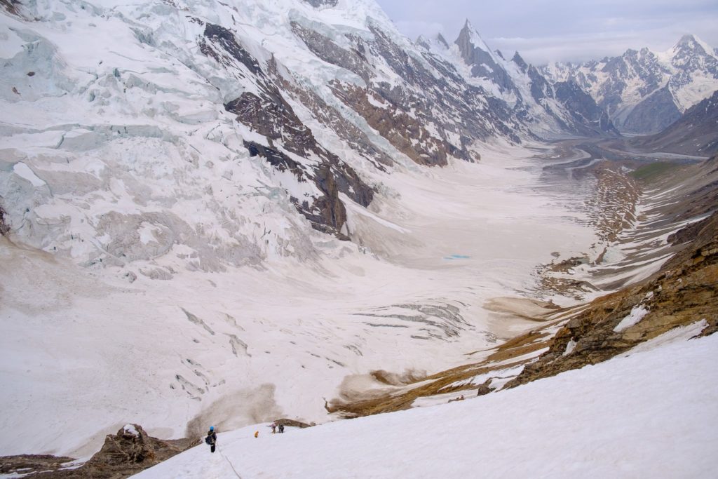
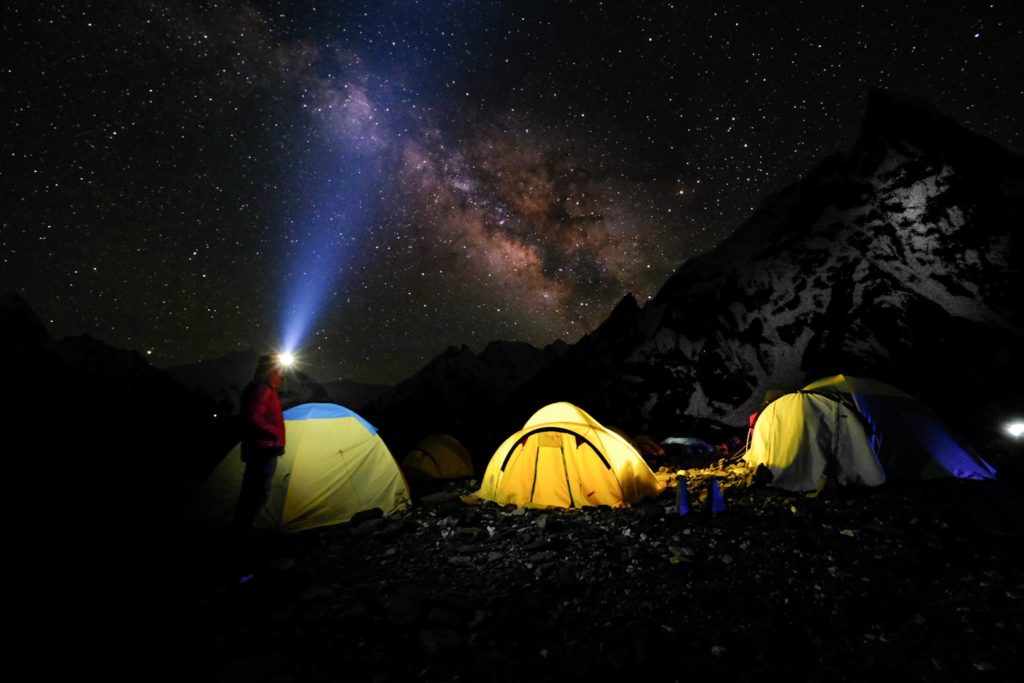
Trail report: 10-12 hours of trekking. Groups set off in the dark by headlamp around midnight (it is advisable for slow trekkers to leave around 9 or 10 pm). From Ali Camp, it is 4-5 hours of steady climbing to gain the top of the Gondogoro La pass.
Once atop the La, one can enjoy stunning sunrise views of every major peak in the area.
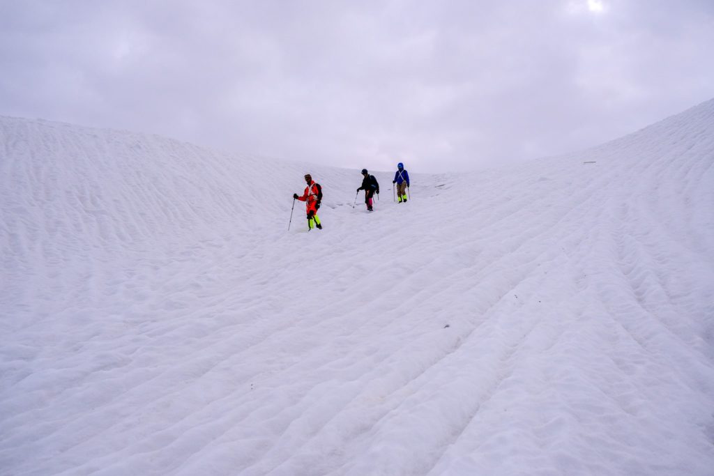
Every group prays for clear weather of course! The descent from Gondogoro La into the valley below is done with the assistance of a series of fixed ropes. Extreme care needs to be taken on the descent (helmets will be worn) and all trekkers should be clipped into the rope from their climbing harness.
Microspikes or crampons should be carried for the descent, but are rarely needed as the slop is a mix of rock and deep snow (not so much ice).
Trekking from the top of the pass to Kuisbang Camp takes about five hours. If the weather is clear, the group will be treated to incredible views from the camp of Laila Peak, located just down the valley.

Day 13: Kuisbang – Saicho (3435 M)
Distance: 22 km
Trail report: 6-8 hours of trekking. The first two hours are on a glacier moraine before the landscape changes into a green, hilly, easy trail. There are a few small river crossings and several steep, exposed sections to be expected as well. The landscape here could not be more different from where we started near Jhula. It is green, lush, and there is no dust!
A beautiful, well-spaced campsite with multiple stream systems running through it awaits us at Saicho.
Day 14: Saicho – Hushe – Drive to Skardu
Distance: 12 km
Trail report: 2-3 hours of trekking. The trek ends from this side in the beautiful Balti village of Hushe.
Here it is customary to take a final cup of chai and say goodbye to the team of porters before making the journey back to Skardu by jeep (6-7 hours depending on road conditions).
Groups usually have lunch halfway to Skardu. Once you reach the hotel in Skardu, be prepared for one of the best showers of your life!
Wifi and Electricity on the Trek
Internet: As recently as early 2021, the whole breadth of the Askole to K2 Base camp distance meant no internet connectivity. This is still pretty true for the most part. Like I said above, there is now an SCOM tower at Concordia where you can pick up enough signal to have a Whatsapp call, check your email, your crypto portfolio (just kidding), etc.
Maybe in the future connectivity will improve – but to be honest I hope it doesn’t. The remote mountains are among the final frontiers free from the online world, notifications, emails, social media, and all the BS that comes with it.
If you don’t have a SCOM SIM card, don’t expect to find any wifi connection along the trail.
Some of the mountaineering expeditions on K2 and Broad Peak sometimes bring satellite internet devices with them – but plans for such devices are EXPENSIVE AF.
Electricity: Almost every expedition brings along a generator on the back of a mule. The generators almost always need to be coerced into actually running – but eventually – some handy porter gets it running after a lengthy battle. The generator allows you to charge your camera, phone, etc. I still recommend bringing a lightweight solar panel though as the sun is usually more reliable than these beat-to-hell generators.
How Much Does the K2 Base Camp Trek Cost?
The cost of Trekking to K2 Base Camp varies across the board. The price for a local Pakistani person is also different for a foreigner – somewhat because of the permits involved and also the level of service that is offered.
A quick Google search will reveal a vast array of tour companies offering to fulfill your dreams of conquering the K2 Base Camp trek. One thing is certain though: not every tour company delivers the same value.
Budget vs Mid Range K2 Base Camp Expeditions
The entire spectrum of quality can be found among tour operators in Pakistan. Bare-bones budget hikers might be keen to go for the cheapest possible option, which may end up being ok in the end. For a trek of this duration and caliber though – it is very important to think about what sort of experience you want to have.
I found that there are three tiers of quality when it comes to this trek: budget operators, mid-level operators, and luxury operators.
The trips I run for Epic Backpacker Tours fall into the middle category and we sell trip spots for £2950 (summer season 2022).
The one trip I have sat in on with an all-Pakistani team was a bit rough. We did not have enough food most of the time, we had no tables and chairs, no toilet tent, pretty mediocre lunches, and generally a low level of comfort. We did have excellent staff – they were just limited because their budget was so low to start with.
I totally get that people have different budgets and standards and I am very happy to see Pakistani people and folks with low budgets still enjoying the mountains and embarking on this trek.
I am just saying that people use to western standards should think twice before joining a budget local expedition. Again this is only my opinion gleaned from what I have observed over the years of running trips here myself.
If you are interested in joining me on the next K2 Base Camp Trek I run, click the link, and please reach out!
Wrap Up: Trekking to K2 Base Camp Musings
By now you should be stoked on what lies ahead for you if you are planning on embarking on the journey to K2 Base Camp.
I’ve done a lot of long-distance hikes in Pakistan and across the world – and I’ll say it with conviction – the K2 Base Camp Trek is one of the best hikes in the world – period. The incredible landscapes, the vast remoteness, the Balti culture, the tasty food – the whole package makes for an experience you’ll never forget.
Best of luck on your epic adventure!
If you found this guide helpful, let me know in the comments below!
Interested in buying a print? Check out my print store! If there is a photo you see in this post not available in the print store, send me a message. I can always do custom prints of any photo you see on the site.
For the sake of transparency, some of the links in my content are affiliate links. This means that if you book a hotel, buy a piece of gear, or sort your insurance through a link here, I earn a small commission at no extra cost to you. Your support helps to keep the site going! Thanks guys!























Great write cheers from the karakoram!
thanks for the support!
Yo Chris, found your site while doing K2 BC trek Google search. Extremely helpful site, nicely done. Awesome work man!
I am heading out to K2 BC in few weeks and looking forward to an epic and safe adventure. Who knows, I might see u on the trail. ðŸ˜
@khansolohiker
Nice! Hope it was an awesome hike!
Hi Chris
I live in South Africa, I can’t find any operators, I was thinking of arranging the logistics and getting a group together to go, I hope to cover my costs this way as well, how do I get in contact with a licenced operator in Pakistan?
I will be thankful for any advice you can give me, my own little project possible.
Regards
Rob
Hi Robert. Thanks for getting in touch. I am organizing groups next year (2023) as well – and can help you with everything you need to run a trip. Please email us at [email protected] to learn more and see how we might be able to put something together for you and your team.
Does Paksitani Citizen also need a license to Go to Base camp ?
You need a permit yes since the trek is in a restricted area, but obviously no special visa. It is pretty easy for Pakistani citizens to go to base camp, you just need to do the formalities, etc. Hope that helps! cheers.
how much does it cost K@ Base Camp trek for locals / Pakistanis??
For the trips I lead, the price is the same except we can deduct the cost of the permit since it is a bit cheaper than for foreigners.
Does an Indian female can do the K2 Base camp trek? If so, what all permits requires. Pls let me know
Thank you
No unfortunately. Indian nationals can not get the required visa to do the K2 Trek.